Siirry pääsisältöön

Palvelut


Topografinen LiDAR


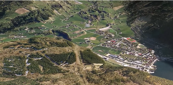
Laser scanning with LiDAR technology have gradually become standard methods for digitizing terrain in 3D. Field has been a pioneer in the Nordic countries, first implementing airborne and later vehicle-mounted laser scanning (Mobile Mapping). In recent years, we have expanded our flight operations across Europe and beyond. We carry out airborne mapping projects for both private and public sector clients, providing valuable insights into the development of terrains, seas, natural landscapes, and urban areas.

Topografinen lidar


Topografinen lidar

About LiDAR technology

It’s a remote sensing method that uses laser light to measure distances. By sending out laser pulses and measuring how long they take to bounce back, LiDAR can create very precise 3D maps of objects and environments. With this technology, we can see terrain, vegetation, and infrastructure like never before, providing actionable insights for smarter planning, design, and decision-making.

How it works
 

LiDAR (Light Detection and Ranging) uses laser pulses to measure distances with extraordinary precision. These pulses are emitted from airborne or ground-based sensors and reflected back from the surfaces they encounter. By analyzing these reflections, advanced processing software assembles millions of points into a three-dimensional representation of the environment - a point cloud.

The density of points can vary depending on flight altitude and sensor settings, ranging from a single point per square meter to over 100 points. This high level of detail allows for accurate and reliable mapping, even in areas covered by dense vegetation.

Airborne LiDAR provides exceptional coverage and detail of terrain that is difficult to survey using traditional methods. By penetrating gaps in vegetation, it can generate precise models of the ground surface. The resulting point clouds can be further processed to classify and separate different objects, including:

  • Terrain surfaces

  • Vegetation

  • Buildings

  • Power lines

This makes LiDAR a versatile tool for a wide range of applications, from environmental monitoring to urban planning and infrastructure design.


Laser_scan_64x64

Ilmakuvaus

Field on historiaa ilmakuvauksesta 1950-luvulta lähtien. Tarjoamme korkealaatuisia sensoripalveluja, jotka tuottavat tarkkaa tietoa digitaalisia tuotteita ja päätöksentekoa varten. Ainutlaatuinen osaamisemme ja ultramoderni lentokone- ja anturikalustomme pystyvät vastaamaan haastavimpiinkin projektivaatimuksiin. Meillä on oma miehittämättömien ilmakartoitusjärjestelmien linjamme, ja lisäksi teemme yhteistyötä paikallisten palveluntarjoajien kanssa maailmanlaajuisesti. Tutustu alla oleviin Field .

Ota yhteyttä

Peter Mero

Suomi

Peter Mero

Managing Director Suomi

+358 40 4808010

Floris Groesz

Kansainvälinen

Floris Jan Groesz

Business Manager AI & Remote Sensing

+ 47 986 30 541

Ulrika Jalkemyr

Ruotsi

Ulrika Jalkemyr

Liiketoimintayksikön johtaja, ilmakartoitus

+46 702 553 554


Paikkatietoratkaisut, jotka perustuvat ohjelmistoihin, sensoreihin ja tekoälyteknologioihin.

Liity joukkoomme ja auta keräämään ja muuntamaan tarkat paikkatiedot arvokkaiksi oivalluksiksi ja digitaalisiksi kaksosiksi.